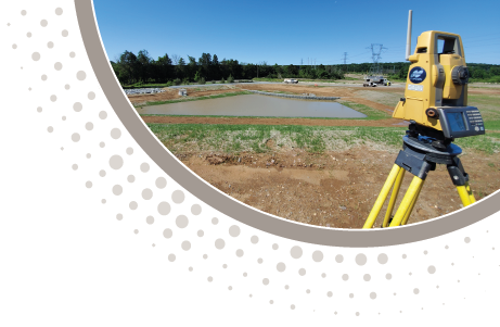
Within the context of a complicated and densely regulated environment, Triad’s surveying and mapping services and professionals embrace the challenges of navigating projects through to a successful completion on time and on budget. While maintaining high standards of ethics, values and professionalism, Triad deploys an array of state of the art geospatial technologies which process and deliver the field data acquired by these technologies via the latest software engines. All of Triad’s work is completed and certified in accordance with applicable local, state and national standards. Triad maintains contractual partnerships with geomatic engineering industry leaders providing the opportunity to offer a multitude of options and therefore solutions to meet the requirements and challenges of any project.
Our Surveying & Mapping Services Include:
- ALTA/NSPS Land Title Surveys
- Boundary Retracement
- Subdivision Planning and Platting
- Design Level Base Mapping
- Topographic and Planimetric Survey Mapping
- Transportation Corridor and Right-of-Way Mapping
- Existing Conditions/As-Built Surveys
- Aerial Photogrammetry
- Lidar Mapping
- Hydrographic Surveys/Hydraulic Cross-Sections
- Subsurface Utility Mapping
- Construction Surveying
- FEMA Flood Certifications and Letters of Map Amendment
- Hazardous Material Site Surveys (Requires OSHA 40-Hour Certification)
- Settlement Monitoring and Structural Deviation Surveys
-
Quantity Volumetric Surveys
- stockpiles, excavations
- Oil and Gas Industry Pipeline and Well Location Survey
- Mining/Quarrying Industry Surveying