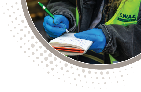
• Pennsylvania Fill Policy Change

    By:Triad Engineering

    By: Carol Phillips
    Senior Environmental Scientist, Triad Engineering, Inc.

    soil samplingThe PADEP new Management of Fill Policy took effect on January 1, 2020 and applies to fill placed outside of a project area. The policy does not apply to fill used within the same project area or right-of-way. The policy has impacts on most earth-moving projects. The new policy provides procedures for determining whether fill is “clean fill” or “regulated fill” as well as guidance on how fill can be utilized. To determine if fill is “clean fill”, environmental due diligence must be completed. The due diligence can be fulfilled by completing a Phase I ESA or testing of the fill material. If testing is completed, a Sampling Plan must be completed, and samples must be analyzed and compared to standards tied to the Act 2 criteria. Triad can complete the environmental due diligence necessary under the new Management of Fill Policy and can assist in navigating reporting and permitting with the PADEP. A link to the new policy is below.

    http://www.depgreenport.state.pa.us/elibrary/GetFolder?FolderID=4647

    PADEP has proposed changes to Chapter 105 regarding permits and permit waivers. Triad can complete stream & wetland delineations for your project and navigate the Chapter 105 permitting process for your project. Links to the proposed rulemaking and the PADEP presentation below.

    http://files.dep.state.pa.us/PublicParticipation/Advisory%20Committees/AdvCommPortalFiles/WRAC/2020/013020/Ch105_reg_proposed_WRAC.pdf

    http://files.dep.state.pa.us/PublicParticipation/Advisory%20Committees/AdvCommPortalFiles/WRAC/2020/013020/CHAPTER%20105_rev_proposed_WRAC_01-30-20.pdf


  • True North Survey

    By:Triad Engineering

    By: Cyndi Powell and Jon Taylor

    Triad survey was tasked with the unique challenge of establishing a True North survey control monument for a project at the Frederick Regional Airport. This was not your average survey request. The last time anyone within Triad could remember providing a True North bearing on a survey project was nearly 25 years ago.

    Triad was providing construction materials testing and inspection services and survey services in support of the contractor for Phase III Obstruction Removal at Frederick Airport. The scope of the project included relocating the glide slope antenna and automated weather observing system (AWOS). Relocating the AWOS tower required stakeout and construction of a True North monument which is used to align the wind sensor mounted to the tower. The monument was to be established relative to the center of the AWOS tower.

    To establish a True North bearing was essentially a foreign task to our survey staff. To tackle this problem, we did a fair amount of research into methodologies we could employ to  complete the task with a high level of accuracy.defining true north

    Each region of the earth has a grid system that is used to process survey data. This grid system has a “grid North” coordinate. To arrive at a True North bearing, our team had to determine the convergence angle of declination from the “grid North” so that all lines of longitude would be aligned to True North or geodetic North.

    One of the methods we first explored was based on solar observations. We enjoyed the opportunity to stay up all night turning angles to Polaris, but quickly discovered this method was going to be overly time consuming and costly.

    true north vs grid north vs magnetic north

    Our next course of action was to tap into our industry contacts and resources with the National Geodetic Survey (NGS). NGS has valuable and readily available resources to help determine the calculations for a True North survey bearing. We tested three different methodologies offered by NGS and each method yielded the same result giving us confidence in the final product.


    The first method we tested used NGS’s Coordinate Conversion and Transformation Tool (NCAT). Using NCAT, we entered positional data specific to the relocated AWOS tower and the resulting output included a convergence angle for the AWOS tower’s latitudinal and longitudinal position. Next, we struck ‘grid north’ line from the AWOS tower, turned the convergence angle provided from NCAT, and extended that line to the desired distance.

    Another NGS tool we used was a program entitled FORWARD. This program allowed us to enter the latitude and longitude of the AWOS tower and specify the geodetic azimuth and distance we needed to travel. The resulting output was the latitude and longitude of the true north monument to be set.

    Triad survey technician

    Using both methods, we obtained identical coordinates for the true north monument.

    As a final check, we verified that the tower and true north monument coordinates had the exact same longitude using NCAT and AutoCADD.

    With our field data and calculations in place and confirmed, we staked out and installed a physical concrete monument with a brass plate marking the True North bearing in relation to the newly relocated AWOS tower.

    survey monument

    This was a unique challenge for our survey team. In the end, we learned about available resources and developed a new skill set to help us solve these types of problems in the future.

    For more information on our services or questions, please visit the Contact Us page.


  • Eyes On-Site for Owners and Developers During COVID-19

    By:Triad Engineering

    aerial photo of Triad drillingTriad Engineering, Inc. recently introduced drone technology to supplement some of our existing service offerings. This includes topographic and aerial surveys and construction site documentation. The survey data is incredibly accurate and, in many cases, using drones can be more budget and schedule friendly than field surveying. Additionally, during these unprecedented times associated with the COVID-19 pandemic, our use of drones for construction site documentation has been very valuable for owners and developers that cannot travel. The drones allow the owner and developer to have “eyes” on-site to observe the on-going progress of their project.

    Triad is currently employing drones for site documentation of active projects. In compliance with health and safety recommendations related to the COVID-19 pandemic, contractors and developers are restricting domestic travel and doing everything in their power to ensure their jobs sites are safe for all involved. Drones can help contractors and developers monitor their job site progress from the comfort and safety of their homes. Site documentation with drones can help limit the frequency of in-person visits promoting social distancing and facilitate communication between the developer and contractors to ensure jobs are progressing smoothly and safely.

    Site documentation includes aerial video footage and still photos of a job site or project. These services are customizable to meet the client’s needs. Some clients want site documentation weekly, others bi-weeaerial photo, site documentationkly or monthly. Drone footage allows the developer or owner to monitor a project’s progress, identify and prevent potential safety hazards and make adjustments to the budget or schedule based on the information collected. It allows the developer or owner to have site visibility while social distancing. In addition, drone footage is easy to share with various team members for enhanced communication and coordination.

    With the current challenges our world is facing in the wake of COVID-19, a pre-construction meeting or weekly site visit with all project stake-holders is not ideal or simply not feasible, but we all want these projects to keep moving forward so we can keep our staff employed. Drone technology can help!

    Suggested Additional Reading:

    Industry leader DroneDeploy recently emphasized in their article on automation the importance of agility to overcome these challenging times and we at Triad couldn’t agree more.

    For more information on our Drone Services, please Contact Us!


  • Infiltration Best Management Practices (BMPs)

    By:Triad Engineering

    infiltration BMPInfiltration BMPs use temporary surface or underground storage to allow incoming stormwater runoff to infiltrate into underlying soils. The goal of infiltration BMPs is to capture post construction stormwater runoff and allow the water to be spread out, infiltrate natural soils, and allow for positive overflow that discharges excess volume in a non-erosive manner.

    Because infiltration BMPs have a very high runoff volume reduction capability, they typically require less space than other BMPs, which makes them well suited for projects with a relatively small impervious (gravel, highly compacted, paved) drainage area.

    There are numerous BMPs to choose from for structural and non-structural BMPs. Triad is able to plan, design, and permit infiltration BMPs for your land development project, whether it is required by local regulation or needed due to property restraints. We are able to plan early for your BMP by completing infiltration testing and site assessments. Infiltration testing should be conducted during the wet season (January to June) so contact us today to start planning for your project.


  • Linear Project Routing & Slip Prevention

    By:Triad Engineering

    By: Ben Campbell, PE and Carol Phillips, Senior Scientist 

    project photoSelecting a right of way (ROW) for linear projects such as highways and pipelines is a complex and important part of your project. Routing linear projects must take into consideration numerous factors including land use, landowner constraints, buffer zones, ecological & cultural resources, project size, project type, and method of construction. Post construction slips result in costly and timely permitting, construction, and geotechnical issues. Slips are typically on steep slopes and side cuts and are generally caused by saturation from weather, saturation from damaged drainage patterns, soil compaction, and vegetation with shallow root systems and poor cover. Some typical causes of slips include:

    1. Construction in poor soil types and fragile slopes
    2. Groundwater pressure acting to destabilize the slope
    3. Loss of vegetation, soil nutrients, and soil structure
    4. Erosion of the toe of a slope by waterbodies
    5. Weakening of a slope through saturation by precipitation
    6. Weakening of a slope due to improper drainage
    7. Deforestation and removal of deep-rooted vegetation
    8. Earthwork that alters the shape of a slope or imposes new loads on a slope
    9. Construction that changes the amount of water that infiltrates the soil

    Triad can assist in ROW selection and routing of linear projects to reduce and avoid landslide prone areas, which may reduce the risk for slips post construction. Due to the location and nature of our work, geohazards such as poor soils and steep slopes cannot always be avoided. Because of this, we can identify areas with high risk potential and plan for them during the routing process. Our team utilizes our combined knowledge of regional geology, ROW planning, engineering design, site restoration, and construction oversight to limit the risk of slips on linear projects. We excel at linear project planning and follow through to construction completion.

    For more information or to schedule a consultation with one of our professionals, contact Morgantown@triadeng.com or 304-296-2562.