

Mapping History: Environmental Insights
By: Jason McCabe
Environmental Practice Leader
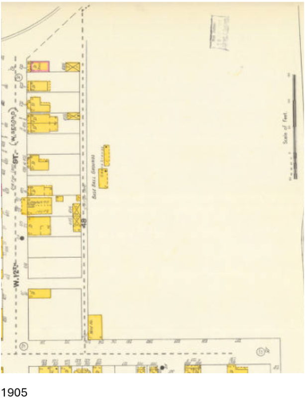
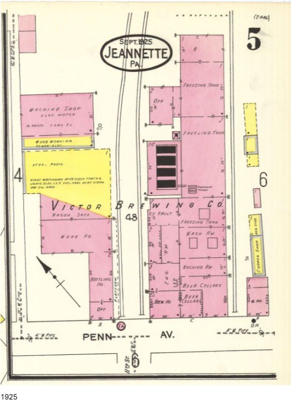
One of the best parts of my job is getting to “play detective”…or at least that is how I think of it. This work includes many different methods, but spending time researching the documented history and background of sites can be both educational and enlightening. For instance, when we are completing environmental site assessments, reviewing sources such as fire insurance maps can provide historic insight that most people do not even know exist. The precise drawing, mapping, and labeling of individual buildings, all hand drawn to scale, is to many a lost art. However, these were the tools that insurance companies in the late 1800s and early 1900s used to determine premiums and levels of coverage for their clients. Today, environmental professionals access and review these drawings to determine a different level of risk, mainly for individuals looking to buy or redevelop property. But historic maps like these are more than just background sources. Many are so detailed that the reader can almost visualize a streetscape or neighborhood as it appeared over a century ago, long before cameras or motion pictures became commonplace. Seeing where underground gasoline tanks were located in 1930 or how many coke ovens lined the railroads paints a picture of the industry that built our nation. On other projects, we use historic mining maps to locate surface portals, access shafts, and underground tunnels used by coal companies around the turn of the century. While these maps were originally created to estimate coal reserves or resource ownership more than one hundred years ago, we use them today to identify preferred drilling locations for abandoned mine discharge treatment system designs.
 So, which of our clients do these resources benefit? Nearly all of them. Developers in housing, industrial, commercial, and energy sectors rely on documents of a property’s past use to help identify what is known in our industry as the best and most practical use. Real estate agents use this information to identify priority or interested clients. Local, state, and federal governments rely on it for redevelopment efforts, including repurposing historic sites or businesses that are no longer feasible.
Often, past industrial sites present new and insightful opportunities, usually in the form of Brownfield sites, that are guided by the history or legacy of the property. Using historical information like that discussed above, environmental professionals can narrow down or even eliminate what are known as constituents or chemicals of concern and develop a risk-based approach to site cleanup. Sometimes the risk outweighs the investment for a developer, and alternative uses for a site are explored. Other times, the developer knows exactly what they want to build and where it will go. In those cases, we can clean the site to the level required to protect human health and the environment while redeveloping the property into a viable and economically feasible asset for the community.
Almost none of this takes place without an in-depth assessment of a site’s history. So, the next time you see an old map on the wall, a black and white photo of an unfamiliar street, or even a blog from a local historical society, keep in mind that these pieces of history may hold the key to the future of that location. And it all starts with some upfront detective work.
______________________________________________________________________________
Interested in exploring historic maps for yourself? Many of these resources are available online at no cost through university libraries and public archives, including collections maintained by Penn State University (https://libraries.psu.edu/about/collections/sanborn-fire-insurance-maps) and the Library of Congress (https://www.loc.gov/collections/sanborn-maps/). These collections provide access to Fire Insurance Maps that offer insight into the historical development and past uses of properties across the country. For additional resources specific to your area, consider reaching out to your local library or historical society, which are often excellent starting points for uncovering local site history. Or contact a Triad Environmental Professional for in depth information!